


GPS is one of America’s foremost technological gifts to the world. GPS tracking systems can give continuous position reports through a satellite and/or cellular network. In India, the first satellite of the GPS-aided GAGAN system is already in orbit.
Navigation is serious business as any pilot will testify. Since the earliest days of commercial aviation, the aim has been to reach destination safely, efficiently and on schedule, all these calling for teamwork between pilots and air traffic management (ATM). Navigation instruments and tracking devices have become more precise and reliable over the years making the task simpler. For almost two decades, satellite navigation has been a game changer, providing unprecedented levels of accuracy, irrespective of the weather and consequently making ATM that much easier.
A satellite navigation system uses satellites to provide autonomous geo-spatial positioning around the globe. Small electronic receivers as also other devices fitted on aircraft help determine their location (latitude, longitude and altitude) to within a few metres, using time signals transmitted from satellites. If the system has global coverage, it is called global navigation satellite system (GNSS). A cherished principle of international GNSS is that services will be freely available to all users without user charges.
Wouldn’t the ATM staff breathe easier if all aircraft were precisely where expected at any given point in time? While the current satellite navigation systems help to determine position to the nearest five or ten metres, augmented instruments can reduce this margin of error to a few centimetres. If that isn’t accuracy, what is?
Give Me GPS
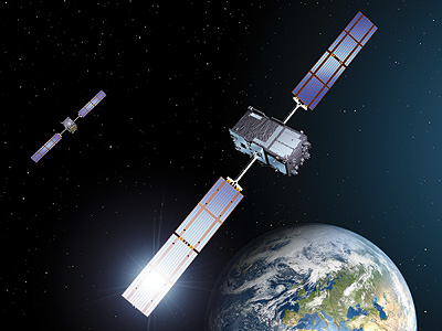
Satellite navigation was kick-started by the US NAVSTAR global positioning system (GPS) in 1994. Soon thereafter the Russian global navigation satellite system (GLONASS) emerged while Europe, China, India and Japan are currently in various stages of forming their satellite navigation constellations. Why are countries investing astronomical sums in building their own systems, despite having free and unrestricted access to GPS? Perhaps because, apart from navigation and ATM, other vital facets of a nation’s infrastructure such as telecommunications, transportation, utilities, financial networks etc are critically dependent on GPS to determine position, navigate accurately or keep the time correct to a billionth of a second. It is not a comforting thought that all this may someday be subject to the whims and fancies of a foreign power even though that nation may be friendly today. However, a large number of exclusively national systems would greatly limit the potential user benefits. Therefore, such systems are designed to be interoperable while retaining exclusive national capabilities.
GPS, maintained by the US, is where it all began. GPS is one of America’s foremost technological gifts to the world. It is freely accessible to anyone with a GPS receiver and provides location and time information anywhere on or near the earth where there is unobstructed line of sight to four or more satellites in orbit. Next on the cards is a total system redesign designated as GPS-III. While still “backwards compatible” with existing user equipment, GPS-III will have up to 36 satellites orbiting at 20,200 km to provide more powerful signals. It will also have a new operational ground control segment and revamped security architecture. A cross-linked command and control design will allow the entire constellation to be updated from a single ground station. Lockheed Martin has been awarded the initial development and production contract. The first launch of a GPS-IIIA satellite is expected in 2015 and all 32 advanced satellites are expected to be in place by 2022. They will triple the quantum of signals available for commercial use, dramatically enhance accuracy and have atomic clocks that keep time to a fraction of a billionth of a second.
GLONASS and the Rest
What about the others? GLONASS is owned by the Russian Government. It complements the US-owned GPS and is currently the only alternative navigational system with global coverage and comparable precision. Although it has been through hard times, the full constellation was restored on December 4, 2011, enabling total global coverage. A group of 31 GLONASS satellites is currently in orbit, with 24 in operation and four in reserve. The GLONASS design has undergone several upgrades, the latest version being GLONASS-K. This has a life span of 10 years, compared to the seven-year life span of the earlier GLONASS-M. Its signals will be more powerful and accurate.
Not to be left behind, the European Space Agency (ESA) is in the process of fielding Galileo, a satellite navigation system intended primarily for civilian use. Operationalisation of the 30-satellite system is expected by 2019. By offering dual frequencies, Galileo will deliver real-time positioning accuracy down to metre level which is unique for a publicly available system. It will guarantee availability and will inform users within seconds of failure of any satellite. This makes it eminently suitable for applications where safety is critical such as on approach for aircraft landing. Galileo will be interoperable with GPS and GLONASS and a single receiver will be able to determine the position using signals from satellites of any of these systems in any combination.
China has also taken giant strides towards developing a GNSS. Its COMPASS system with 10 satellites in orbit became operational over China in December 2011. COMPASS will ultimately consist of 35 satellites, including five geostationary earth orbit (GEO) satellites and 30 medium earth orbit satellites. There are plans to offer services to customers in the Asia-Pacific region later this year and globally by 2020.
Meanwhile, India awaits the Indian regional navigational satellite system (IRNSS) which will consist of seven satellites built, launched and controlled indigenously. IRNSS should provide an accuracy of better than 7.6 metres not only throughout India but approximately 1,500 km around it. The first satellite of this GEO constellation is expected to be launched early in 2013, while the full constellation may be ready in 2014. Like Galileo, the two-frequency INRSS is expected to be more accurate than a single-frequency system.
Then there are satellite-based augmentation systems. These generally consist of a widespread network of high-accuracy monitor receivers with very precisely surveyed latitude and longitude positions. The monitors continuously receive raw data from the constellations’ satellites and the difference between the calculated position and the true surveyed position is the error at that time and location. These errors are continuously uploaded to dedicated satellites and retransmitted to all aircraft as automatic receiver corrections. In India, the first two satellites of the GPSaided geo augmented navigation (GAGAN) system are already in orbit and certification is expected by June 2013. It will enhance the integrity and accuracy of GPS signals to three metres so as to meet precision approach and landing requirements. GPS, however, remains the gold standard and other satellite navigation systems will probably find it hard to match the GPS capabilities.