

Indian Regional Navigation Satellite System
The IRNSS will rid the nation of its dependence on the existing GPS owned by the United States
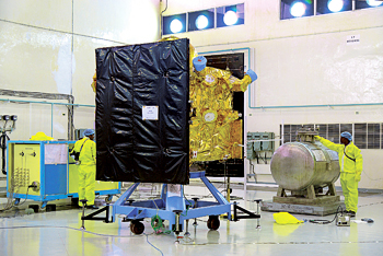
By July next year, hopefully, India will have its own global positioning system (GPS) created by the Indian Space Research Organisation (ISRO) which will rid the nation of its dependence on the existing GPS owned by the United States. Called the Indian Regional Navigation Satellite System (IRNSS), it will consist of a constellation of seven satellites in orbit and a ground support segment. The four satellites already in orbit are the IRNSS-1A, 1B, 1C and 1D. The three remaining satellite i.e. IRNSS 1E, 1F and 1G, will be launched in January, February and March of 2016 respectively. Three of the satellites will be located in suitable orbital slots in the geostationary orbit and the remaining four will be located in geosynchronous orbits with the required inclination and equatorial crossings in two different planes. All the satellites of the constellation are being configured identically. The satellites are configured with I-1K Bus to be compatible for launch on-board the polar satellite launch vehicle (PSLV).
The ground segment of the IRNSS constellation would consist of a Master Control Centre (MCC), ground stations to track and estimate the satellites’ orbits and ensure the integrity of the network (IRIM) as well as additional ground stations to monitor the satellites with the capability of issuing radio commands to them. The MCC would estimate and predict the position of all IRNSS satellites, calculate integrity, make the necessary ionospheric and clock corrections and run the navigation software. In pursuit of an independent system, an Indian standard time infrastructure would also be established.
When operational, the IRNSS will provide GPS connectivity to the entire country including even the rural parts of India with the accuracy of within 20 metres which will match the accuracy provided by the American GPS. Data from the IRNSS can be used both civil and military aircraft for navigation in the region extending up to 1,500 km from the Indian borders.
SP's AirBuz - CURRENT ISSUE